


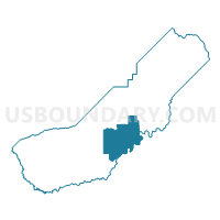
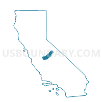
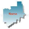
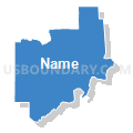
Voting District 10085, Madera County, California
About
Outline
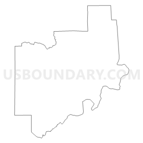
Summary
| Unique Area Identifier | 534768 |
| Name | Voting District 10085 |
| County | Madera County |
| State | California |
| Area (square miles) | 184.07 |
| Land Area (square miles) | 181.03 |
| Water Area (square miles) | 3.04 |
| % of Land Area | 98.35 |
| % of Water Area | 1.65 |
| Latitude of the Internal Point | 37.08682420 |
| Longtitude of the Internal Point | -119.70706840 |
Maps

Graphs
Select a template below for downloading or customizing gragh for Voting District 10085, Madera County, California


Neighbors
Neighoring Voting District (by Name) Neighboring Voting District on the Map
- Voting District 10065, Madera County, CA
- Voting District 10070, Madera County, CA
- Voting District 10075, Madera County, CA
- Voting District 10080, Madera County, CA
- Voting District 10105, Madera County, CA
- Voting District 10120, Madera County, CA
- Voting District 10130, Madera County, CA
- Voting District 10135, Madera County, CA
- Voting District 50480, Madera County, CA
- Voting District 50485, Madera County, CA
- Voting District 50500, Madera County, CA
- Voting District 54510, Fresno County, CA
- Voting District 54525, Fresno County, CA
- Voting District 54825, Fresno County, CA
Top 10 Neighboring County Subdivision (by Population) Neighboring County Subdivision on the Map
- Fresno CCD, Fresno County, CA (664,000)
- Madera CCD, Madera County, CA (92,437)
- Sierra CCD, Fresno County, CA (18,981)
- Yosemite Lakes CCD, Madera County, CA (14,481)
- Oakhurst-North Fork CCD, Madera County, CA (13,969)
- Madera Southeast CCD, Madera County, CA (5,319)
Top 10 Neighboring Place (by Population) Neighboring Place on the Map
Top 10 Neighboring Elementary School District (by Population) Neighboring Elementary School District on the Map
- Bass Lake Joint Union Elementary School District, CA (12,108)
- Raymond-Knowles Union Elementary School District, CA (1,267)
Top 10 Neighboring Secondary School District (by Population) Neighboring Secondary School District on the Map
- Yosemite Unified School District in Bass Lake, CA (12,108)
- Yosemite Unified School District in Raymond-Knowles, CA (1,267)
Top 10 Neighboring Unified School District (by Population) Neighboring Unified School District on the Map
- Clovis Unified School District, CA (189,683)
- Yosemite Unified School District, CA (10,604)
- Golden Valley Unified School District, CA (10,400)
- Sierra Unified School District, CA (9,980)
- Chawanakee Unified School District, CA (4,684)
Top 10 Neighboring State Legislative District Lower Chamber (by Population) Neighboring State Legislative District Lower Chamber on the Map
Top 10 Neighboring State Legislative District Upper Chamber (by Population) Neighboring State Legislative District Upper Chamber on the Map
Top 10 Neighboring 111th Congressional District (by Population) Neighboring 111th Congressional District on the Map
Top 10 Neighboring Census Tract (by Population) Neighboring Census Tract on the Map
- Census Tract 1.08, Madera County, CA (7,068)
- Census Tract 5.09, Madera County, CA (5,935)
- Census Tract 10, Madera County, CA (5,319)
- Census Tract 1.06, Madera County, CA (5,021)
- Census Tract 64.05, Fresno County, CA (4,795)
- Census Tract 1.02, Madera County, CA (4,163)
- Census Tract 1.09, Madera County, CA (2,392)
- Census Tract 55.15, Fresno County, CA (1,653)
Top 10 Neighboring 5-Digit ZIP Code Tabulation Area (by Population) Neighboring 5-Digit ZIP Code Tabulation Area on the Map
- 93619, CA (28,965)
- 93636, CA (11,908)
- 93614, CA (11,661)
- 93602, CA (3,862)
- 93643, CA (3,171)
- 93626, CA (1,359)
- 93645, CA (318)